Trail Walking La Bresse - De L'auberge des Alisiers à la Piquante Pierre  - Photo

De L'auberge des Alisiers à la Piquante Pierre

© OpenStreetMap contributors
Length
Length
11.4 km
Max alt
Max alt
1029 m
Uphill gradient
Uphill gradient
291 m
Km-Effort
Km-Effort  
15.3 km
Min alt
Min alt
882 m
Downhill gradient
Downhill gradient
289 m
Boucle
Boucle
Yes
Creation date :
2015-10-04 00:00:00.0
Updated on :
2015-10-04 00:00:00.0

(0 Reviews)

Walking
Walking
2h37
Difficulty : Easy

Scan this QR Code to open this trail in the SityTrail application

FREE GPS app for hiking

Logo SityTrail SityTrail

IGN / Geographical institutes

Download SityTrail from the App Store Download SityTrail from Google Play

Logo SityTrail SityTrail World

The world is yours!

Download SityTrail from the App Store Download SityTrail from Google Play Download SityTrail on Huawei AppGallery

About

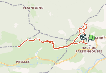
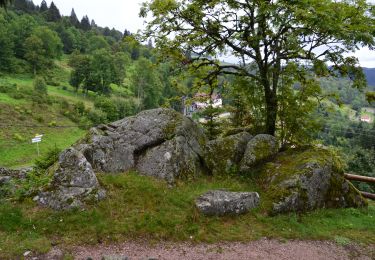
Trail Walking of 11.4 km to be discovered at Grand Est, Vosges, La Bresse. This trail is proposed by jeanclaude12.

Description

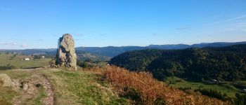
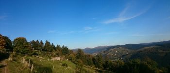
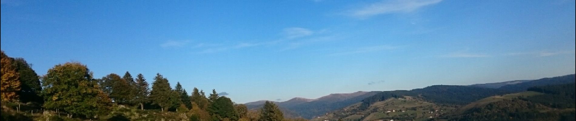
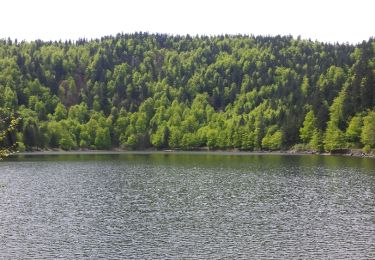
Très agréable randonnée aérienne et en balcon au-dessus de la Vallée de la Moselotte. Les vues sont panoramiques vers la Route des Crêtes, le Col du Brabant et le Col des Hayes.

Elevation profile

Photos

Points of interest

Point of interest Basse-sur-le-Rupt - La Piquante Pierre - Photo
jeanclaude12
BASSE-SUR-LE-RUPT 
Point of interest Cornimont - La Roche des Chats  - Photo
jeanclaude12

Positioning

Country:
France
Region :
Grand Est
Department/Province :
Vosges
Municipality :
La Bresse
Location:
Unknown
Start:(UTM)
338538 ; 5318059 (32T) N.

Trails nearby

Trail Walking La Bresse - la bresse - le moutier des fées  - Photo
Walking
GUIDE
stef789

Walking

Very easy
(1)
La Bresse, Grand Est, Vosges, France
26 km | 36 km-effort
3h 26min
No
Trail Walking La Bresse - Le Couchetat - Photo
Walking
fedinois1

Walking

Very easy
(2)
La Bresse, Grand Est, Vosges, France
4.8 km | 7.4 km-effort
1h 50min
Yes
Trail Walking Cornimont - Xoulces _ Grand Ventron _ Vieille Montagne - Photo
Walking
jeanclaude12

Walking

Medium
(1)
Cornimont, Grand Est, Vosges, France
15.6 km | 25 km-effort
5h 6min
No
Trail Mountain bike La Bresse - randonnée découverte à la Bresse.  - Photo
Mountain bike
Dutyrider

Mountain bike

Easy
(1)
La Bresse, Grand Est, Vosges, France
30 km | 41 km-effort
2h 58min
Yes
Trail Walking La Bresse - Le col du Brabant et le lac des Corbeaux - Photo
Walking
VacheKiri67

Walking

Medium
(2)
La Bresse, Grand Est, Vosges, France
10.3 km | 16.4 km-effort
3h 51min
Yes
Trail Walking La Bresse - Le Moutier des Fées_backup_backup - Photo
Walking
GUIDE
Desrumaux

Walking

Easy
(1)
La Bresse, Grand Est, Vosges, France
9.1 km | 15.4 km-effort
3h 11min
Yes
Trail Horseback riding Gerbamont - 2022-06-05 Rando CVA Gerbamont Dommartin les Remiremont - Photo
Horseback riding
GUIDE
holtzv

Horseback riding

Difficult
Gerbamont, Grand Est, Vosges, France
24 km | 34 km-effort
5h 10min
No
Trail Horseback riding Gerbamont - 2022-06-04 Rando CVA Gerbamont Boucle Foret de Noire Goutte - Photo
Horseback riding
GUIDE
holtzv

Horseback riding

Very difficult
Gerbamont, Grand Est, Vosges, France
31 km | 43 km-effort
6h 2min
Yes
Trail Walking La Bresse - Grand tour de
Walking
Decelle

Walking

Medium
(1)
La Bresse, Grand Est, Vosges, France
7.1 km | 9.8 km-effort
2h 17min
Yes


Close
My subscriptions